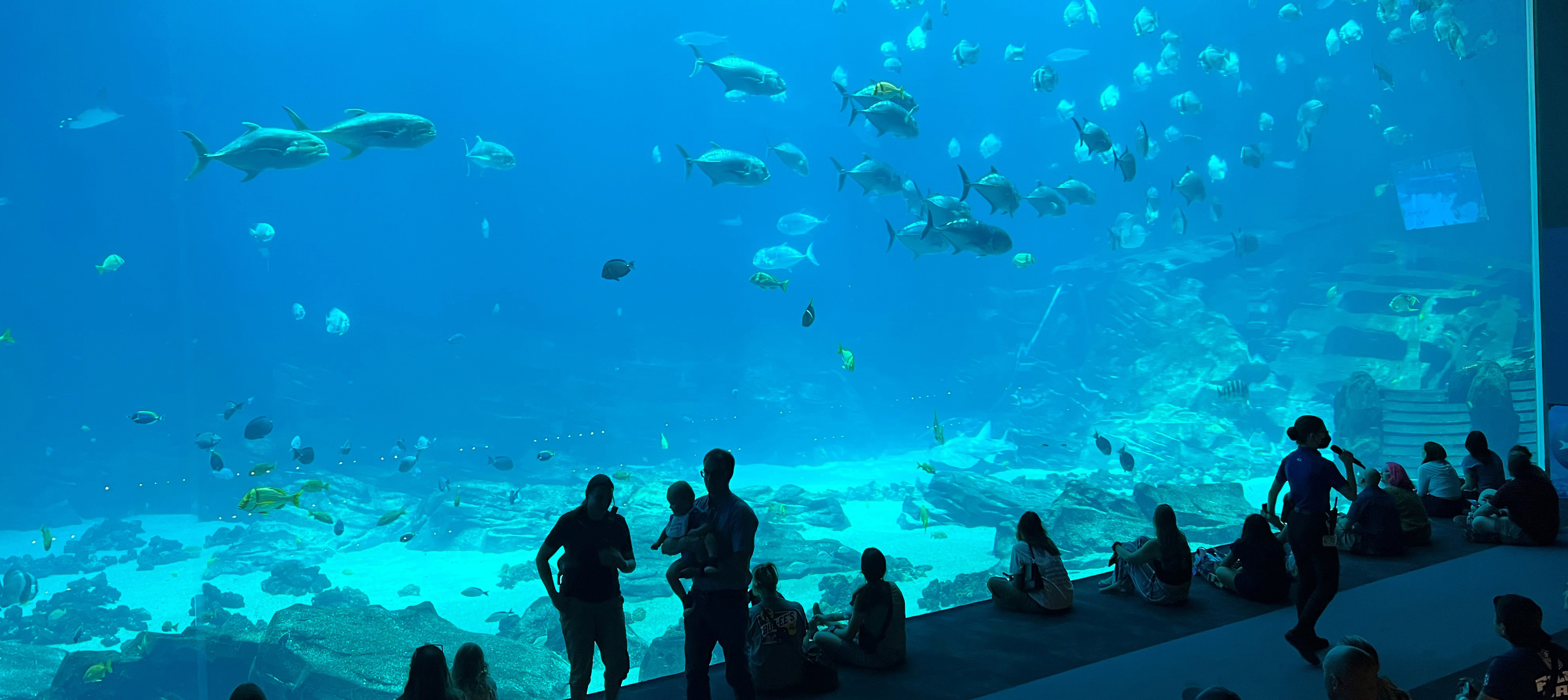
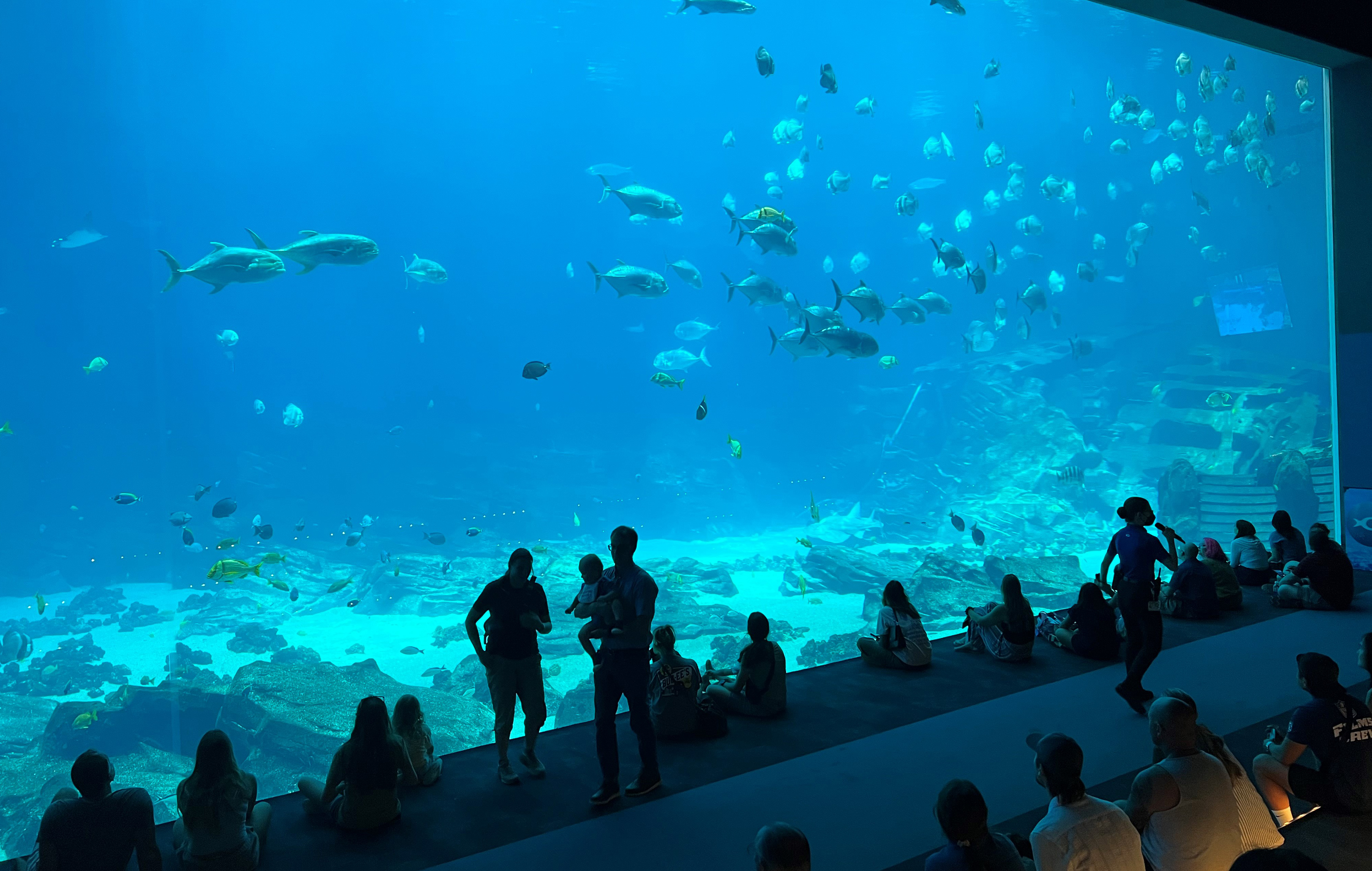
Georgia Aquarium’s Ocean Voyager gallery delights millions of visitors a year with manta rays, a 30-foot whale shark, and thousands of other creatures gliding through a 6.3-million-gallon tank that is among the largest aquatic exhibits in the world.
But until now, the Aquarium hasn’t known the exact dimensions of the massive habitat or the precise locations of the rocks and other underwater structures within it.
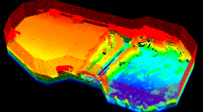
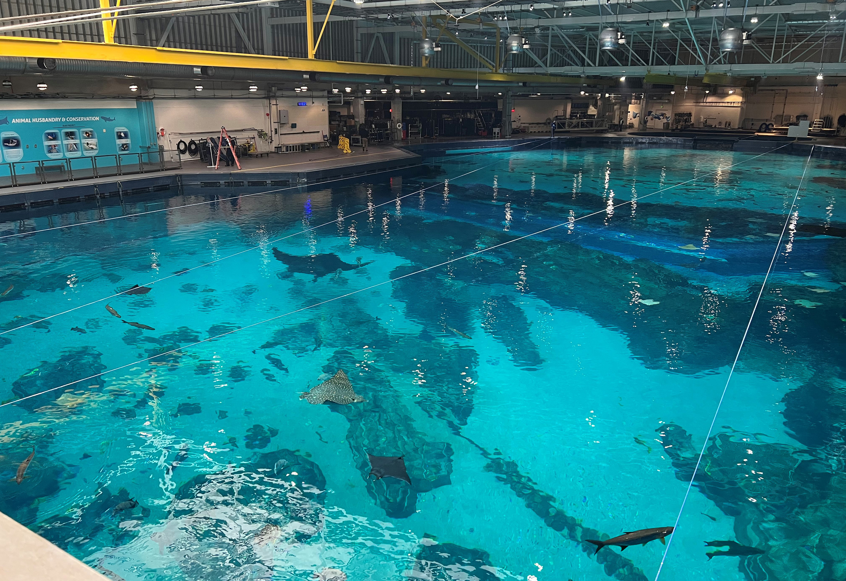
Using a light detection and ranging (lidar) system originally designed to chart underwater coastal structures from the air, engineers from the Georgia Tech Research Institute (GTRI) recently mapped the tank for Georgia Aquarium planners. They used the habitat’s own movable gantry system, operating just above the water’s surface, to scan the lidar across the surface of the tank – as the fish swam calmly below it.
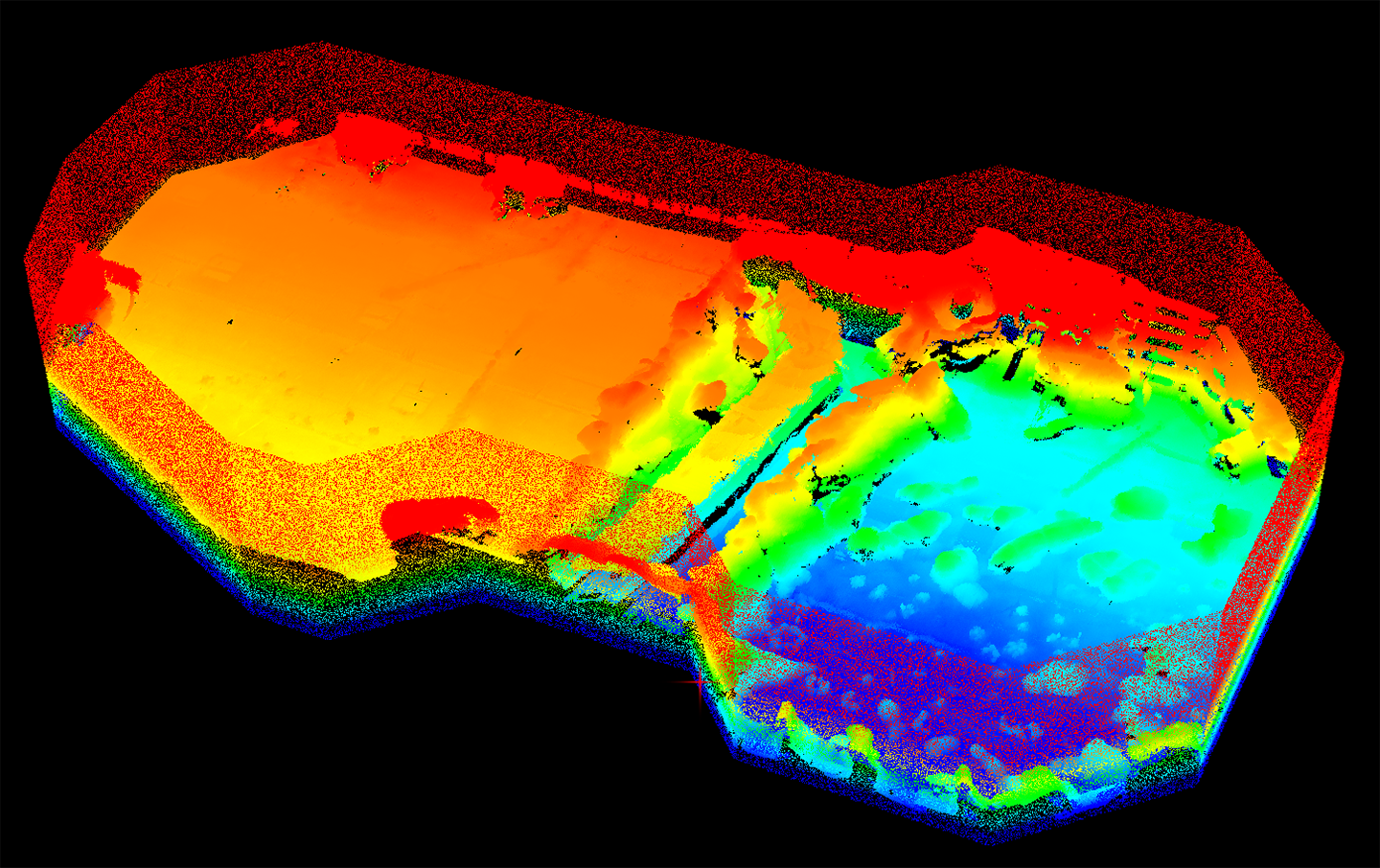
“We are excited to partner with Georgia Aquarium to provide them with a detailed map of this amazing facility,” said Eric Brown, a GTRI senior research engineer who co-led the mapping project. “The goal was to show all of the underwater features and rock formations using millions of points produced by the bathymetric lidar system. This may be a first of its kind use of lidar technology to map a large indoor aquarium tank.”
The largest exhibit at Georgia Aquarium, Ocean Voyager – built by The Home Depot – is now home to more than 50 different species of fish. The gallery has 4,574 square feet of viewing windows, a 100-foot-long underwater tunnel that allows visitors to see the fish from below, and one of the largest aquarium viewing windows in the world.
“When we opened this facility 22 years ago, there were things that may not have been thought about at the time,” said Kelly Link, Associate Curator for Fishes and Invertebrates – Ocean Voyager at the Aquarium. “We’ve made some changes, and know that through the years ahead, we’re going to learn more and may need to make more changes. Having a really good map of the habitat will help us understand where we might want to make future modifications.”
When Georgia Aquarium added a shipwreck decoration, for example, the planning required measurements done by divers. The new 3-D map will provide the level of detail necessary to design any future modifications.
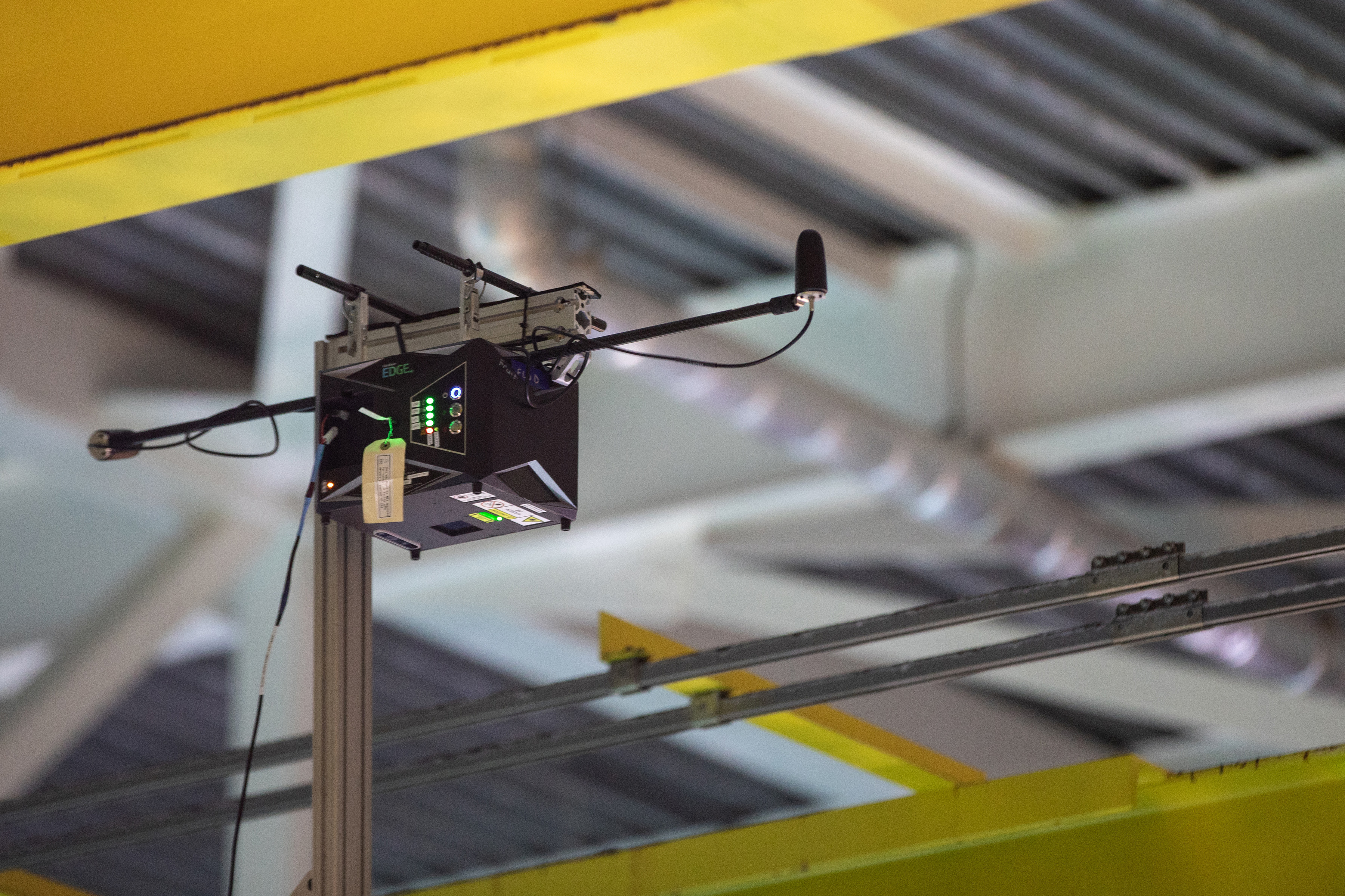
To create the map, GTRI engineers mounted an ASTRALiTe lidar on the gantry above the Ocean Voyager tank. As the gantry moved across the surface, the lidar’s green laser passed through the water and bounced back from structures below the surface. The returned laser light was captured by the lidar, which normally uses GPS data to produce a 3D map of the points measured. Inside the Aquarium, however, there was no GPS signal, so a custom solution was devised. The researchers used a supplementary laser range finder to measure the movement of the lidar, and they combined data from the two instruments in software to produce a 3D map of the exhibit.
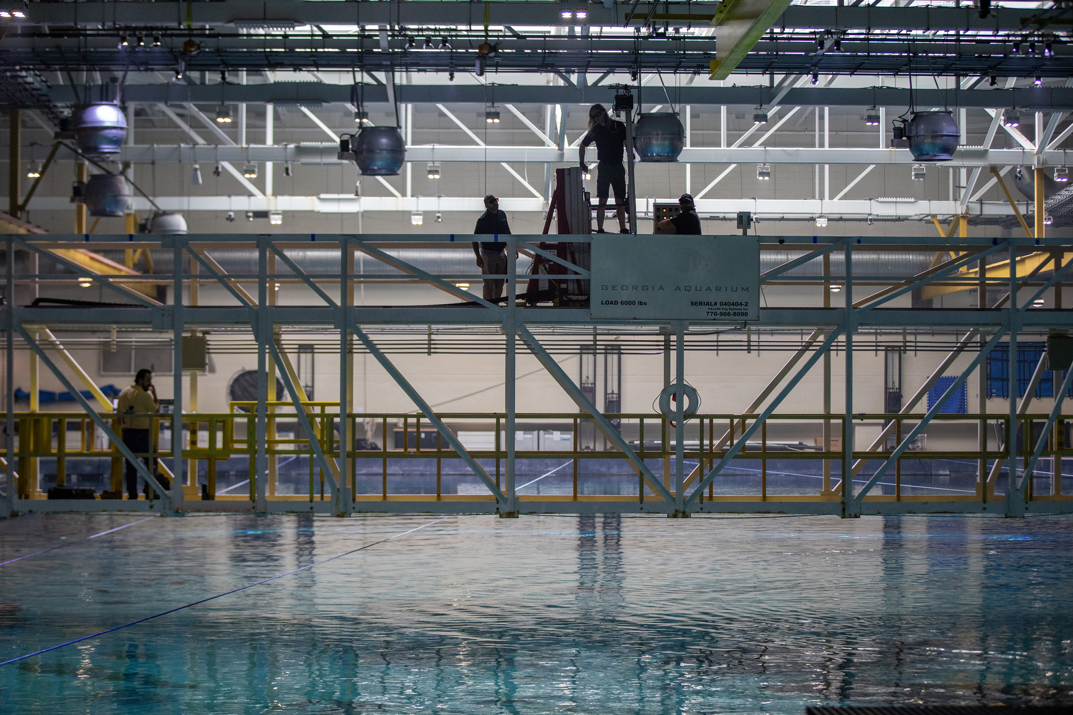
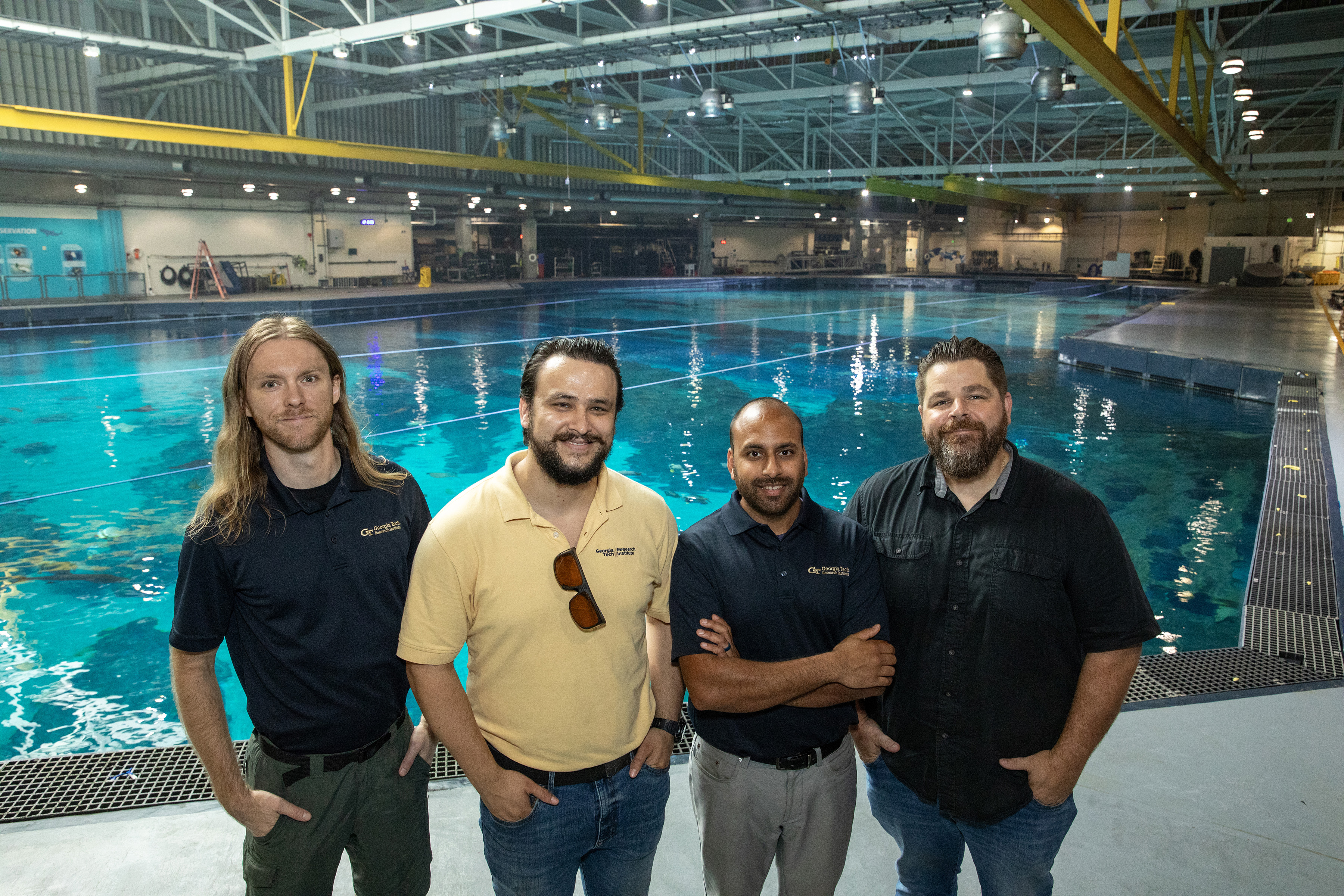
Brown and Senior Research Engineers Priyank Patel and Jacob Faile, along with Research Scientist Ian Winski, monitored the device on the gantry and regularly checked the data being captured by a laptop computer operating nearby. The gantry moved at approximately 1.5 miles per hour across the surface, which is approximately the length of a football field.
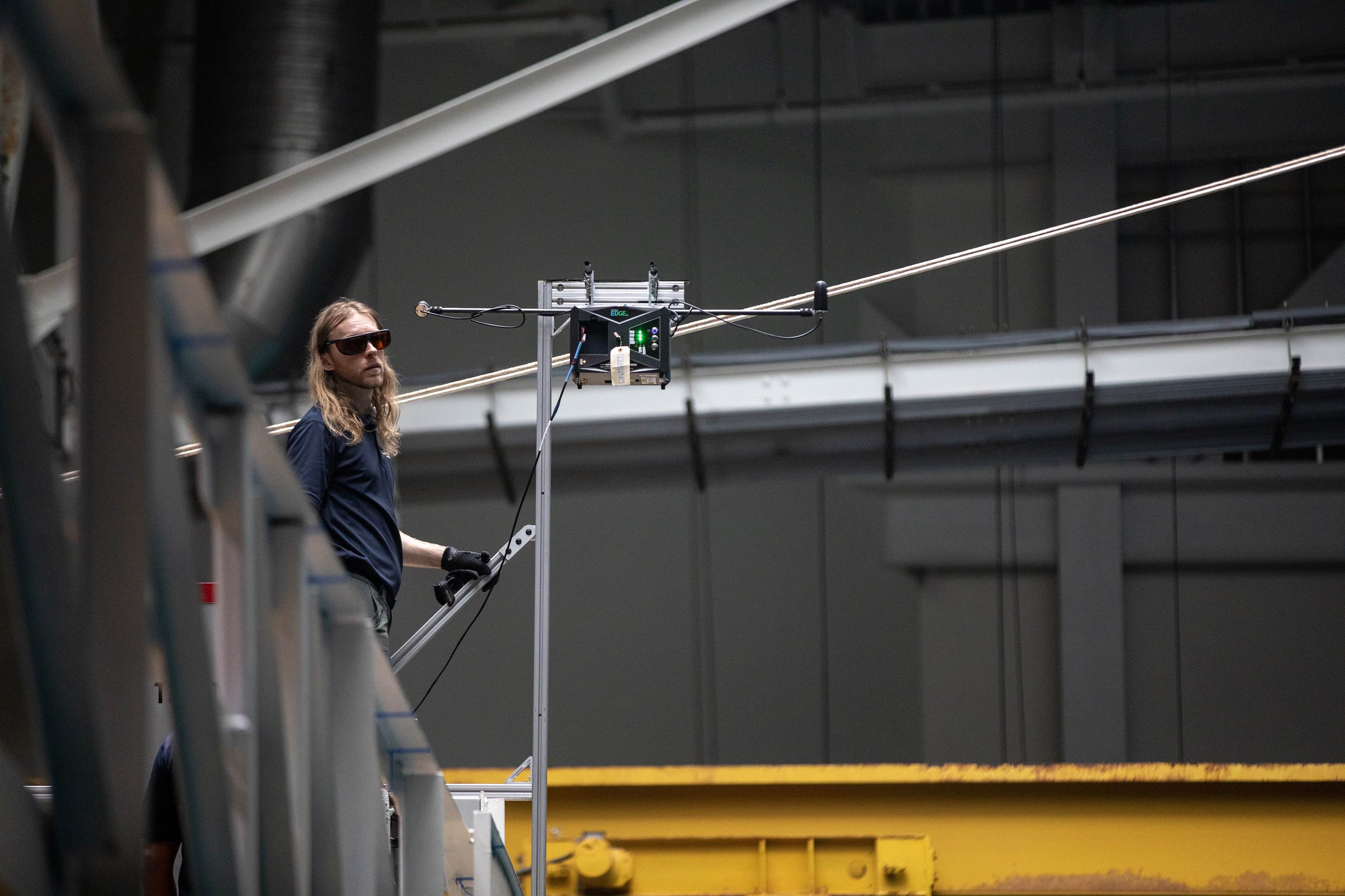
Mapping lidars used from aircraft typically make numerous passes – comparable to the pattern used to mow a lawn – to ensure coverage for all areas of interest. Because the lidar was just 19 feet above Ocean Voyager’s surface, the laser beam remained narrower than when it operates from an aircraft, so each pass covered just 91 inches, including a 20 percent overlap.
The inhabitants of the massive tank provided some unique technical challenges. The manta rays, whale shark and smaller fish briefly blocked the laser as they swam beneath the moving gantry. To overcome that issue, the researchers made two passes of the gantry across each section of the tank.
“Just by probability, we expected that if we ran the lines forward and backward, the animals would have changed position enough so that any location blocked on the first pass would be visible on the second,” Brown said. “That mostly worked and we were able to capture the information we needed.”
Another concern was ensuring the safety of the researchers and animals below the lidar’s green laser beam. At the height where it was used, the laser was considered safe for humans, and Aquarium scientists determined that was also true for the animals below.
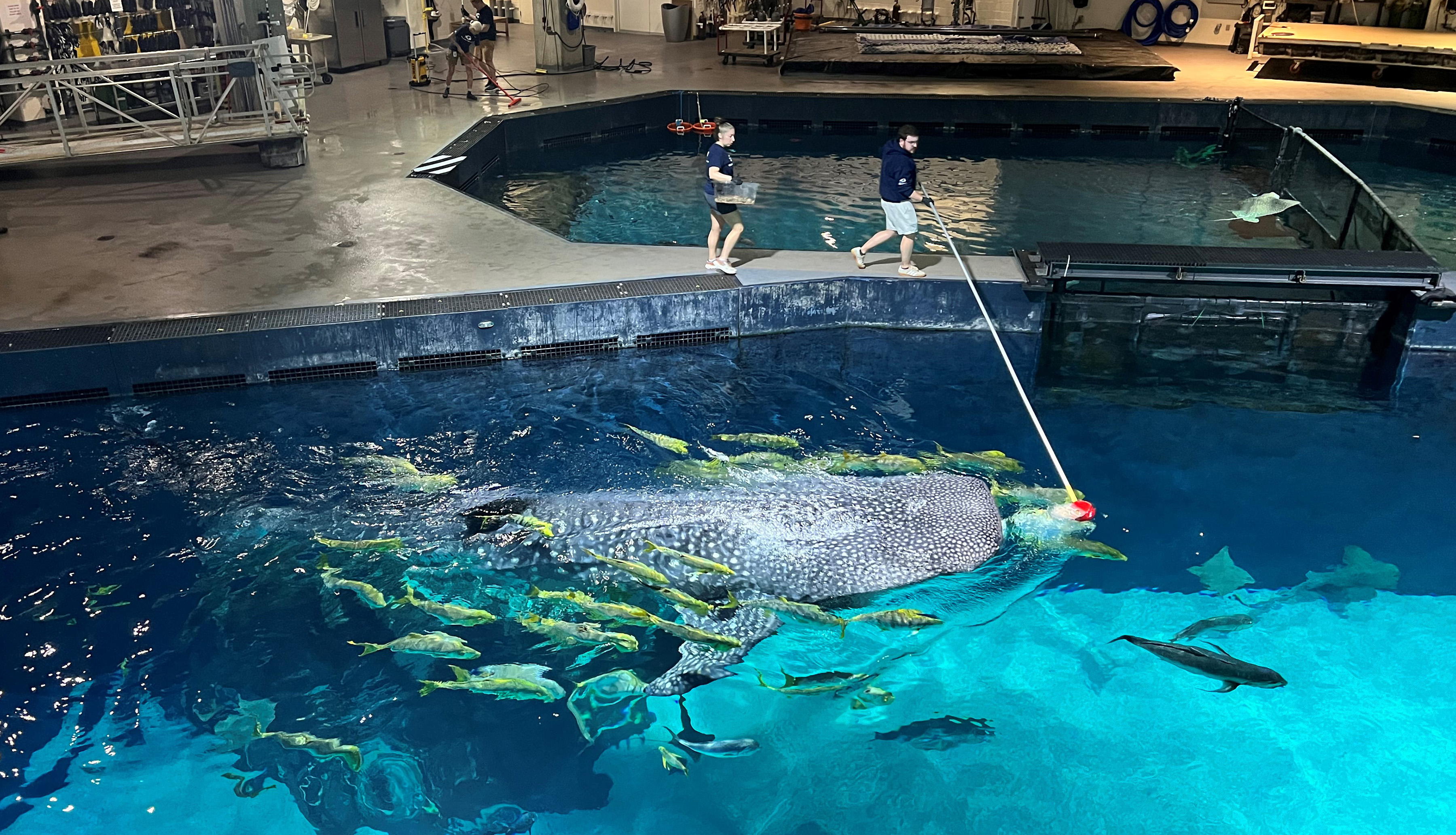
Researchers also worried that the fish might be attracted to the green laser beam, just as cats are drawn to laser pointers. But trial runs showed that the laser light entering the water didn’t significantly affect the behavior of the animals.
Collection of the lidar information required one-and-a-half days, after which the GTRI researchers used computers to produce a three-dimensional point cloud image that also provides detailed measurement information. The point cloud data can be analyzed using standard engineering software to provide distance information. It can also be converted into a three-dimensional model for use in computer-aided design (CAD) software, supporting future modifications to the exhibit.
“It’s a nice visual representation, but there is also spatial data built in so the Aquarium can measure the distances between different points in the tank,” Brown said.
GTRI has long experience with lidars, which are commonly used in military applications, for atmospheric research, and to map underwater structures. The collaboration is one of several between Georgia Tech and Georgia Aquarium, which are located just a few blocks apart in Atlanta.
“This was a great partnership to think outside the box on how to use this technology in Ocean Voyager,” Link added. “We are pleased to have worked with Georgia Tech to get the information we need for this habitat.”
In addition to those already mentioned, the GTRI team also included Senior Research Scientist Layne Churchill, Senior Research Engineer Domenic Carr, Research Engineers Matt Gray, Howard Darling and Syed Samin, and Student Assistant Benjamin Reznikov.
ABOUT GTRI: The Georgia Tech Research Institute (GTRI) is the nonprofit, applied research division of the Georgia Institute of Technology (Georgia Tech). Founded in 1934 as the Engineering Experiment Station, GTRI has grown to nearly 3,000 employees, supporting eight laboratories in over 20 locations around the country and performing more than $1 billion of problem-solving research annually for government and industry. GTRI's renowned researchers combine science, engineering, economics, policy, and technical expertise to solve complex problems for the U.S. federal government, state, and industry.
Writer: John Toon (john.toon@gtri.gatech.edu)
GTRI Communications
Georgia Tech Research Institute
Atlanta, Georgia USA

Related News